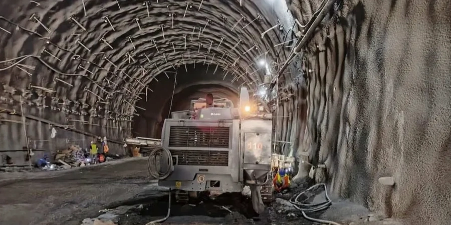
Total stations, inclinometers, and vibrating wire piezometers. That is the gear our field crews deploy across Fort Worth excavation sites every week. Monitoring an open cut along the Trinity River floodplain or a deep basement near Sundance Square means tracking multiple parameters simultaneously. Lateral movement on soldier pile walls. Settlement behind the shoring. Groundwater drawdown around the excavation perimeter. We run automated data loggers that push readings to the cloud every 15 minutes. The project engineer checks thresholds from the office. If a soldier beam deflects beyond the design limit, the alert fires immediately. No lag. No waiting for a weekly report. That real-time feedback loop has stopped problems before they became failures in the expansive Eagle Ford Shale that underlies much of Fort Worth. Our deep excavation instrumentation package covers the full monitoring spectrum required by local building officials and OSHA trench safety regulations.
A soldier pile wall in Eagle Ford Shale can move 0.25 inches without warning after a heavy rain. Automated monitoring catches that shift before the adjacent street feels it.
Technical details of the service in Fort Worth
Demonstration video
Risks and considerations in Fort Worth
Fort Worth grew fast. Brick warehouses from the 1920s stand next to modern steel-frame towers. Digging a 40-foot basement between them creates a real risk of undermining historic foundations. We have monitored excavations where the shoring was just 8 feet from an occupied building with shallow spread footings on stiff clay. Pre-construction condition surveys documented every hairline crack in the mortar. During excavation, settlement points on the building facade showed 0.15 inches of downward movement over three weeks. That triggered a review meeting with the contractor and the structural engineer. The solution came from real data, not guesswork. This is the value of instrumented monitoring. It replaces anxiety with actionable measurements. For excavations near the railroad corridors that crisscross the city, we add vibration monitoring per FTA guidelines to protect sensitive track alignments. A liquefaction assessment may also be warranted for deep excavations near the Trinity River where loose saturated sands could amplify ground movement during the excavation sequence.
Our services
We provide instrumentation and monitoring services that cover the full lifecycle of a Fort Worth excavation project. From baseline readings before the first shovel hits soil to post-backfill verification surveys, here is what we deliver.
Inclinometer & Wall Deflection
Probe inclinometers installed in grouted casings behind soldier pile and secant walls. We measure lateral displacement profiles and compare against design limits daily.
Settlement & Building Monitoring
Optical survey networks on adjacent structures, streets, and utilities. Our crews run level loops with digital levels and record settlement to 0.04-inch precision.
Piezometer & Groundwater Tracking
Vibrating wire and standpipe piezometers to monitor pore pressure changes during dewatering. Essential for excavations below the water table in Trinity River alluvium.
Automated Alert & Cloud Reporting
Data loggers push readings to a secure web dashboard. Threshold exceedances trigger SMS and email alerts to the project team within minutes of the reading.
Frequently asked questions
What does a geotechnical excavation monitoring program cost in Fort Worth?
For a typical commercial excavation project in Fort Worth, plan on US$960 to US$2.890 per month depending on the number of instruments, reading frequency, and reporting requirements. A basic program with 4 settlement points and 2 inclinometers runs toward the lower end. A full program with automated piezometers, vibration monitors, and a cloud dashboard with daily reporting reaches the upper range. We provide a fixed-price proposal after reviewing the shoring plans and site constraints.
How often should excavation monitoring readings be taken?
During active excavation, we recommend daily readings on inclinometers and settlement points. When the excavation reaches final depth and wall movement stabilizes, frequency can step down to twice weekly. After a heavy rain event in Fort Worth, we always run an immediate extra reading cycle. Expansive Eagle Ford Shale responds quickly to moisture changes, and a wall that was stable on Tuesday can show movement by Thursday morning after a storm.
What triggers an alert in your monitoring system?
We configure two thresholds per instrument: a warning level (typically 50-70% of design allowable movement) and an action level (80-100%). If a soldier pile wall deflection hits the warning threshold, the system sends an email to the project engineer. If it crosses the action threshold, SMS alerts fire to the entire response team. The design engineer sets these numbers based on the shoring calculations and the tolerance of adjacent structures.
Do you handle the permitting and reporting for OSHA compliance?
Yes. Our monitoring reports are formatted to satisfy OSHA 1926 Subpart P requirements for excavation safety. We document the competent person inspections, instrument readings, and any threshold exceedances with time-stamped records. The cloud dashboard provides an audit trail that demonstrates continuous monitoring throughout the excavation period.
Can you monitor excavations near historic buildings in Fort Worth?
Absolutely. We have monitored deep excavations adjacent to early 20th-century masonry buildings in the Near Southside and downtown. The approach includes pre-construction condition surveys with high-resolution photography, vibration monitoring per FTA criteria during demolition and excavation, and optical settlement points on multiple elevations of the historic facade. We typically set tighter threshold limits for these structures, often 0.10 inches of total settlement versus the 0.25 inches commonly allowed for newer construction.